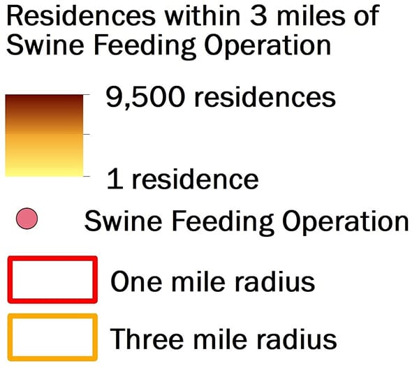
Data on the maps represent the location of permitted swine feeding facilities recorded by the North Carolina Department of Environmental Quality as of January 26, 2018. EWG used those facility locations to determine the count of residential parcels within a one- and three-mile radius and the center of a residential parcel. Parcel boundaries for all 100 North Carolina counties were taken from NC ONE MAP – GeoSpatial Portal and represent property delineations from 2014 to 2017.
To establish a residential parcel the parcels were filtered to extract only parcels with a structure onsite, a residential type parcel use description, or a land use code associated with a residence. Those parcels were further subset to keep only properties less than or equal to 10 acres, in order to filter out larger parcels which would reduce accuracy. The parcel’s center point was used to determine if it was within a one to three miles of the approximate location of a swine feeding operation. If more than one facility was associated with an operation, the location point was typically in the center of all the operations. To estimate population, we used 2.6 people per household, the state average derived from 2010 U.S. Census data for each county.